 |
 PARIANA, comune di VILLA BASILICA, nr LUCCA, TUSCANY, ITALY |
|
PARIANA, comune di VILLA BASILICA, nr LUCCA, TUSCANY, ITALY |
HOME ~ CASA SAN MOSCATO ~ MOSCATINO ~ GROUNDS & SURROUNDING AREA ~ BOOKING & AVAILABILITY ~ HOW TO GET THERE ~ PHOTOS ~ THINGS TO DO ~ WALKING IN TUSCANY |
WALKING IN TUSCANY
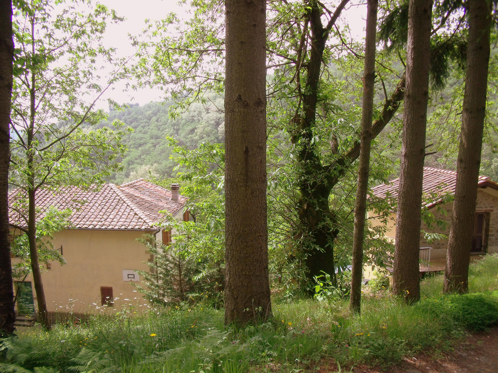
There are five types of walking on offer- low hills, local to San Moscato, along forest tracks through fragrant pine, acacia and chestnut woods, with occasional stunning views, and breaks for olive groves with vines, vegetable gardens and villages: Appennines, which is mountain tracks which climb through sunny woods to upland meadows and on to soaring peaks: Apuan Alps, which is the marble mountain range near Massa and Carrara - dazzling crags plunging to the coastal plain: rocky coast, where precipitous cliff paths hang above the sparkling waters of the Golfo dei Poeta at la Spezia and the coast to the north: and town walks off the beaten track in many towns and villages, large and small. More detail about these later. First, about finding your way . Walking is a popular pastime in Italy (il trekking in the vernacular) and there are clear paths for recognized walks, generally marked by flashes painted on to the rocks. They are often numbered as well, but the numbering system suffers from the drawbacks typical in such systems such as that the numbers on the ground differ from those on the map, the courses of paths change and numbers inexplicably change or peter out. From experience it seems a red-and-white or blue-and-white flash indicates a main path which can be relied upon to go somewhere, even if not the place you want to go to: plain red or blue indicate untrustworthy paths, sometimes better avoided. There are plenty of maps, but nothing with the minute accuracy of our ordnance survey. To be fair, Italian mapmakers have a much more vertical landscape to contend with than we are used to in England. The walkers maps they produce, however, tend either to be impressionistic and nothing more than a general guide, or so minutely detailed that you are overcome by swathes of contours and cliff-faces and cannot see the wood, literally, for the trees. However, it is best to have a map and they are on sale in bookshops and even tabacchi. For other general information about dress etc. and a glossary see at end. Do however take lots and lots of water - at least a litre per person on a high walk. ~ Now on to the walks. ‘Low hills’ is a relative term. They are on the tree-clad foothills to the true mountains and include the Pizzorne (the range on whose north side sit San Moscato itself, and the nearby villages of Pariana and Villa Basilica, and whose south side forms the ‘Colline Lucchesi’), the hills surrounding Pescia (the ‘Val di Nievole’) and other lower hills. They rise to around 400 metres. They are criss-crossed by mulattiere (mule tracks) used by foresters, hunters and for access to the local chapels on the hillsides each of which is the site of a festa on the day of its patron saint. These old tracks are the original roads, built when travel along the valley floors was impossible. Frequently these days one encounters tough little cars bumping along at constant risk of ‘bottoming’ on a rock or getting bogged down in one of the many fords. Walking along them is pleasant, cool (shady), fragrant (especially in pine-woods) and less strenuous than the mountains (although they can be pretty steep) and the trees every now and again thin to give wonderful views of the surrounds. One very pleasant such walk, taking about an hour each way, starts at San Moscato itself and goes to Villa Basilica. Unfortunately, for this and the other walks on the Pizzorne there is no proper walkers’ map, just map 1 (see list of maps at house at end) which gives no more than an impression of the geography and does not show this path at all. It is included in the area shown on map 2(1) but caution is required because apart from Valleriana Trekking itself, which is scarlet, everything on that map – paths, contours, electricity lines, parish boundaries, precipices etc – is denoted by indistinguishable black lines. San Moscato’s street address is ‘via di Villa Basilica’ (as stated on the house number by the front door) and indeed the path which passes the house is the old road from Pariana to Villa Basilica. From the house you go down the track to the molino (mill). Incidentally, a branch of this path through an overgrown and nearly vertical field leads to quite an impressive waterfall. We only discovered this after we had had the house for 14 years, though it is just a couple of hundred yards from San Moscato. At the molino cross the stream and climb the extremely steep path on the other side (from which, in spring at least, you get good views of San Moscato itself, and also of the snowy mountains around Abetone). At the top you take the path down to the left and after various twists and turns with some yappy dogs and isolated houses, chickens and goats, you are on a path (partly tarred these days) about half way up the side of the hill which eventually comes out of the woods into the small hamlet of Capornano, from where the path (now a little road) winds through orchards and gardens to the typically vast and ornate cemetry of Villa Basilica. From there a sort of via dolorosa leads past the stations of the cross and some fine tall old houses into the main square of the village. Both bars in the village sell very good ice-creams and the basilica is worth a visit. A special feature of this walk is that you pass several springs and it is worth taking a cup and sampling them as you go along. The first is at San Moscato itself, the next at the molino, the next half way along in the woods, the next on the via dolorosa (although when last visited that one appeared to have dried up) and the last, complete with modernista statue, in the square. This last seems to be famous, because we have seen people filling up plastic demijohns at it. Another feature is the tantalising glimpses of the basilica along the way. To return, retrace your steps. There must be another way back further up the mountain, but we have never found it. From the place with the yappy dogs one of the roads, by way of variant, runs down to Biecina from where you can walk back up the tarmac road with all the hairpin bends, which takes about 20 mins ~ Another walk, taking about the same time, starts from Villa Basilica, or rather from the nearby hamlet of Duomo. This word normally means ‘cathedral’ and you may speculate as to why it is applied to a tiny settlement with only a small church, especially when the next door village is called ‘basilica’. When you start to drive up the valley from Collodi, if you lift up your eyes you will see on your left a small group of houses clinging improbably to a ledge high up the hillside. This is Duomo, and it is on the road which runs out of Villa Basilica up to the top of the Pizzorne, and it is equally spectacular close to, with fantastic views over the plains. Park near the dustbins on the approach to the village. You enter through one arch and leave by another, just outside the second taking the track which forks left rather than the small road which leads up into the mountainside. From there a stony track descends to cross a large stream and rises again to the far side of the horseshoe valley, leading through woods and eventually passing over to the south side of the hills and the vine-growing area of the Colline Lucchesi. The large village that then comes into view below is San Gennaro, but if instead of going there you keep along the tarmac path, descending gradually with lovely views, you come to the village of Petrognagno where there is a viewpoint (complete with restaurant) from which the whole plain of Lucca may be surveyed – Montecarlo with its distinctive church-tower on the left, the Pisan hills (Monte Pisano) and, on a clear day, the Colline Metallifere far to the south, beyond Volterra and the Cecina river, in the middle, and Monte Mattana and the beginnings of the Apuan Alps to the right. Lucca itself is somewhere in the middle ground, to the right of the panorama, but surprisingly difficult to make out. Best time is when the sun is upon it in the morning, when high landmarks like the Torre Guinigi (with bushes on top) are visible. At your feet the hillside swirls down covered by vines and little villages and churches to the via pesciatina, the old main road that runs along the fringe of the hills and links Lucca and Pescia. Again, there are doubtless other ways back, but when we have done this walk we have returned the way we came. This walk is shown as a track on map 1, and can be identified on 2(1). Continuing (by car) up the road from Duomo one comes to the top of the Pizzorne, where there is a sort of holiday colony, with a restaurant (open only in summer) and a number of bungalows, caravans and other flimsy dwellings. Here too, apart from the single tarmac road there are numerous mulattiere leading off into the bush, making pleasant walks, even if they do not always go anywhere in particular. One of them has a particular interest for occupants of San Moscato. It starts from a lay-by on the left (going down) of the Pizzorne-Villa Basilica road. It is a standard mulattiera, more or less following the contours through chestnut and pine woodland, fording little streams and passing rocky outcrops. It is not far below the top of the Pizzorne, and well above the cultivated zone. In spring there are flowers – scillas, hellebores, hepatica, primroses – and wildlife such as deer and (reputedly) wild boars (I originally wrote ‘bores’, but they are mostly tame) and porcupines. After going quite a long way – a couple of miles, perhaps – you pass under a power line, and a minor path follows the line of pylons, no doubt for servicing them. If you follow it down to the next pylon down from the main path you find yourself at the top of the power line that you can see on the hillside to the west from San Moscato, with a clear view down the firebreak to San Moscato itself. The stream which rises here is presumably the torrente Biecina which drives the molino at the foot of San Moscato’s hill and comes out at the hamlet (more of a road-junction, really) where the Jolly café is. There appears to be a path which follows the stream down but we have never explored it. Again, this walk appears obscurely on map 2(1), but only the Pizzorne road itself appears on map 1. The tarmac road traverses the basically level top of the Pizzorne before descending to Pariana itself and this stretch too gives access to several mulattiere. One of them – it is the second on the right, counting from the Pariana end – goes to Lugliano, as stated on a very small notice at the junction. It branches off at a place where the tarmac road makes a sharp turn to the left, just past a small house or shack, with some sort of aerial on a little tree-fringed hillock at the junction. This is a path similar to the one just described, but as it is on the northern edge of the Pizzorne the views (when discernible through the trees) are of the Appennines and Apuan Alps, rising to around 2000 metres and covered with snow from about November to April. The track descends after 3-4 miles to the village of Lugliano perched on a salient above the valley of the Lima, from which there is a truly magnificent panorama of the valley, and the aforementioned mountain ranges, and the spa-town Bagni di Lucca. There is an alternative way back, by another track which branches off and then rejoins the first. Otherwise, no doubt (but we have not done it) there are other tracks to other Pizzorne villages such as Benabbio and Boveglio. This walk is shown as a track on map 1. ~ We turn now to the other side of the Collodi valley, the hillside which is visible to the south-east from the terrazzo at San Moscato. This is the western arm of the horse-shoe of hills around Pescia, around whose rim runs the long path known as ‘Valleriana Trekking’ which starts at Collodi in the West and ends above Buggiano in the East. We have not walked the whole length of the Valleriana, which is said to be 110 kms. from end to end including all the variants but from what we have seen it is basically through woodland, as described above, but with quite a bit of variety and occasional viewpoints giving wonderful views in various directions. It is not difficult to follow – most of it is mulattiera – but it is confusing at times as many other tracks criss-cross and the red-&-white flashing is not always very clear. It is shown (with its variants) on map 2(1) and we have two Valleriana Trekking guidebooks, both in Italian, giving more precise information than the impressionistic account given here. It is identified on the ground (not very reliably) by ‘vt’ flashes on the waymarkers. The most northerly part of the horse-shoe – near Croce a Veglia – is different: much more rugged and bare, with goats, sheep and cattle grazing the sparse vegetation. This runs down, on its northern side, to the valley of the Lima and has its barren and dramatic limestone rather than the more rounded sandstone of the rest. In fact, it can be accessed by road from the Lima side, a very steep and rough road that runs up by the village of Lucchio, which in a landscape of ‘eagles’ nests’ villages is perched on an exceptionally dramatic ledge. In fact, the rocky outcrop nearby is called ‘Penna di Lucchio’ – ‘the Wing of Lucchio’. It not only has the shape of an unfurled wing, but the rock is also banded black and white giving it the appearance of feathers. An easier road route is from the Pescia side, via Pontito. This mountain fastness formed part of the German defensive line across Italy known as the Linea Gotica in the last war. One way of accessing the Valleriana is by road at, for instance, San Quirico, Sorana or Vellano – see map 2(1). However, it can also be reached on foot by various ‘feeder’ tracks. One of these is from Colognora, another ‘eagles’ nest’ village up the valley from Biecina. If you drive up the main road from Biecina, you quickly come to Pracando: if, at Pracando, you raise your eyes towards the heavens, you will see Colognora clinging to a crag some hundreds of feet above. There is a footpath from Pracando to Colognora, but when we tried it a few years ago it was virtually impassable. From the top of Colognora, however, behind the impressive church, there is an obvious mulattiera heading off in the direction of the Valleriana which does eventually link with it near Monte Battifoglie (‘Mount Rustling Leaves’) (map 2(1)). Another starts at a point down the main road from Biecina, at the junction where the road goes up to Villa Basilica. If you stand with Villa Basilica behind you, over the road from the Banca Toscana, near where the dustbins are, you see a track which leads down across the river by a little bridge and up the other side. Again, you have to exercise care to stay on the right path, but if you do you eventually come to the Valleriana where you can turn right towards Collodi or left towards Monte Telegrafo, the hill with a telephone relay aerial on top which you see from the terrazzo of San Moscato. This is shown as a dotted line on map 2(1). Yet another is from the tower at the top of the old village of Collodi, which straggles up the hill behind the Villa Garzoni. You can either drive up there, using the road by the side of the church in lower Collodi, or walk up the village (see ‘town walks’ below). This is in fact the start of the Valleriana. (Map 2(1)). ~ Another beautiful walk starts from the same point and goes to Pescia. This takes a whole afternoon to go and return. The track at first follows the Valleriana, winding up into the woods easily enough, though a certain amount of serendipity is required at the numerous forks to keep making the right selection. At points along the way you get tremendous views of the plain stretching south featuring Pescia’s futuristic flower market. At a certain bivio [junction] (I am sorry to say I can offer no suggestions for recognising it but there is a handwritten instruction on map 2(1)) you leave the main track and take one which leads down the other side of the hill. You know you are right if and when the rooves and little church tower of Monte a Pescia (a hamlet on a hilltop above Pescia) come into view below. It is not the end of the world if you go wrong: you will just come out above or below where you want to be and may find yourself walking through the garden of a startled local who will however be charm itself if you ask the way. From Monte a Pescia, take the old road (a footpath now) down to one of the city gates of Pescia. There is an alternative way back, lower down the hill, accessed by a path which starts from Pescia. To reach it you follow the road that leads from the main piazza to the station to a little park near a building which glories in the name confartigianato and whose use we have never been able to fathom. The path goes up to the right, reaches the tarmac road to Monte a Pescia at a point called ‘convento’, leaves it further up at a point called ‘Bellacci’ (see map 2(1)) as a clear track through olive groves and stream beds, and ends at lower Collodi. ~ Finally, there are some walks on the Monte Pisano. These, though not very high, are interesting hills, for they stand abruptly between Lucca and Pisa, giving wonderful views of both cities (leaning tower included) and beyond, on the Pisa side, to the sea. To the North, the Apuan Alps and Appennines: to the South, the stony hills of central Tuscany and possibly a glimpse of Elba. Like the Apuan Alps (see below) they are largely made of marble, and although it is inferior to the Carrara marble it has in the past been much quarried and was the stone of choice, needless to say, for the Pisan monuments, including in modern times the paving of the airport passenger terminal (how wonderful it would be if Stansted could be paved in local Essex marble!) The marble gives the hills a rugged barren surface, with good views. Santa Maria del Giudice on the strada statale that goes from Lucca to Pisa is a good starting point. You can park in the village and take Via del Monte up to the Passo di Dante (where there is a statue of the poet, because he mentioned it in one of his poems) which is the pre-motor road through the mountains. There you encounter path 00 which runs along the ridge of the range. Otherwise you can access path 00 by parking in a side road on the left just short of the tunnel entrance on the Lucca side – there is a marked way up from the abandoned cantonal house just before the tunnel entrance. If you turn left (south) on path 00, you can get to the top of Monte Faeta - one of the high peaks (831m) of the Monte Pisano (the other being Monte Serra, 910m, and covered with aerials.) You can equally go north, and take in Moriglion di Penna (462m.) (which we have not actually climbed). On one day in April we saw 5 different sorts of orchid on this path, as well as some eagles. These are afternoon walks rather than a full day, and are shown on map 3. ~ The Appennines are real mountains, rising to 2000m, forming the backbone of Italy rather as the Pennines form the backbone of England. Almost all the routes from east to west - even the autostrade- are therefore dramatic mountain passes, with hairpin bends and tunnels. A geographer will explain why theirs are called Appennines while ours are just Pennines. The walking is similar to rough English hill walking - say, the Lake District - with less mud but more narrow rocky ledges, precipices and rock faces. However, where there are red and white flashes, the path is passable to walkers without special equipment. The main walks are extremely popular, and one is rarely alone. The scenery, needless to say, is quite different from the Lake District - no lakes, for a start, or rather only small ones, and the hills are much more jagged, and the colours dusty rather than mossy. But there are many beauties - small beauties, in the form of sunny groves of trees, splendid rock formations, springs, waterfalls and stream valleys: and grand beauties, in the form of great vistas and dizzying heights. And there is a profusion of wildlife, including birds and wild flowers. Many of the walks are centred on the Appennino Pistoiese - the hills behind Pistoia. From San Moscato these may be accessed either via the Florence autostrada or – more scenically, and in some cases just as quickly – by going over the Passo del Trebbio to Bagni di Lucca and turning right up the valley of the Lima, towards Abetone. You will note that the Lima road is marked ‘Passo del Brennero’ (Brenner Pass), because it was historically one of the main routes through the mountains to the valley of the Po and thence on to the Alpine passes into Austria. ~ One good walk which takes all day starts at Pulledrari (northeast of San Marcello Pistoiese, off the Abetone road from San Moscato – find it on map 1) and climbs to the peak (1945 m.) of Corno alle Scale. There is a good track all the way but see map 2(3) for the details, where it starts as walk 3, then joins 00 [the main trunk ‘MPT’ path] and the last little bit to the peak is path 37. The walk starts in woodland but this gives way to meadows and then to rocky mountain tracks, until eventually you come to a saddle from which you can assault the peak . As you do so, all the scenery to the northwest, which until that point has been hidden, suddenly flashes into view. Back at Pulledrari the rifugio serves very good polenta ai funghi. Abetone itself, at the top of the pass near Monte Cimone, at 2165m the highest mountain in the area, is a ski-resort, complete with fake chalets, but at least this means there are ski-lifts for those not too proud to use them. One of these, for instance, to the west of the road (i.e. on the opposite side from Monte Cimone itself), gives access to the Rifugio Gomito (1852m.) from which it is still a strenuous walk to the Passo di Annibale (through which, allegedly, Hannibal came with his elephants, though I cannot think why, because it is hardly on the way from Carthage to Rome, nor is it a pass, compared to Abetone itself). I hope he had better weather than us: on the day we did this walk, with some Italian friends, it was English-style weather – cloud, turning to dense mist, turning to heavy rain. We reached the passo and carried on to Lago Piatto but could see nothing of either of them, and did not get to the top of the adjacent Alpe Tre Potenze. We were just beginning to feel seriously lost when some very athletic young men, dressed in colourful shorts and T-shirts and holding aloft gigantic umbrellas, emerged from the gloom and put us on the right road. We had seen quite a few people that day picking their way about the peaks with furled umbrellas sticking out of their knapsacks. I thought it looked rather comical, but they had the last laugh when the rain came on in earnest. I tried the same idea later myself in the Yorkshire Dales, but had only partial success in the force 10 gale which prevailed up there. This walk can be picked out on map 2(3) or better on map 4(1). By road Abetone seems a long way from San Moscato but the peaks of which we have just written are the same ones that are to be seen to the north-east from the top of the Pizzorne, and are just the other side of Bagni di Lucca. A good means of access for those prepared to dispense with the ski-lift is the road that leads out of the top right-hand corner of the little park square of Bagni di Lucca to Montefegatesi, another eagles’ nest just to the north (see map 1.) Just beyond Montefegatesi is a gigantic gulf surrounded by rocky crests, known by the sinister name of the Orrido di Botri, where there are a number of walks. One of them is up the stream bed of the Rio Pelago which tumbles down the middle of the gulf (the Val di Botri). To start you follow the road (not all tarmac) beyond Montefegatesi to a parking place a couple of kms further on, where the road bridges the stream, and you just walk up the stream. Before very long you come into a narrow rocky gorge where there is no way forward except to wade in the water, which, needless to say, is piercingly cold even in mid-summer. That, I have to admit, is as far as the writer has penetrated on this walk, but I understand it goes on for a long way further. It is shown on map 2(3) as walk 38, with various alternative ways back. A slightly different version is shown as a circular walk on map 4(1). ~ A completely different walk is around the rim of the gulf. To do this you continue on the road just described to the Rifugio Casentini (map 2(3)). Thence you follow path 14 to Rifugio Fontana a Troghi, and from there follow 12 to Montefegatesi. Here you are some way from your starting point, so two cars are advisable. We actually found a way back via a minor path to the Rio Pelago car park. This walk is also shown on map 4(1), where however the numbering is slightly different, and takes a short day. A special attraction on this walk is that you may well see the local pair of golden eagles (at least, I think they are golden eagles – they are certainly some very magnificent type of eagle) riding the thermals which spiral up from the Orrido below. ~ Another walk, from more or less the same point, is to the top of the Alpe Tre Potenze (1940m.) This is presumably so called because at some dim and distant time three states met at its peak – possibly Tuscany (then ruled by the Bourbons or Habsburgs – I forget which), the papal state of Emiglia Romana and the independent duchy of Lucca. It is still the provincial border of Tuscany and Emiglia Romana. If you look at the map you will see that this is indeed the back of the mountains that lie just west of Abetone, and as already mentioned the Alpe Tre Potenze is right next to the Passo di Annibale. I have to admit we have not done this walk – when we set out to do it from the Rifugio Casentini side we were defeated on one occasion by low cloud and on another (in May) by lying snow – but I imagine it is pretty strenuous, as you climb about 700m. However, the view from the top would make it worth the effort. See maps 2(3) and 4(1). ~ Finally, an easier but very rewarding walk is to the top of Monte Prato Fiorito (1297m.) This lovely name means ‘Mount Flowery Meadow’ and it is the strange rounded mountain you see before you when coming over the Passo del Trebbio to Bagni di Lucca. Its topography is quite different from the Italian norm – a rounded grassy hump like a Lake District fell rather than the usual jagged affair, whence, I suppose, its name – although its slopes on the Bagni di Lucca side are exceedingly jagged. To reach it you take again the road for Montefegatesi, and it lies on your right just before you reach the village. There are a number of ways up, including a path from the village, but the one we normally take starts as a mulattiera a quarter of a mile before the village. There are some houses strung along the track but after a couple of miles you come to a fork where there is a sort of settlement of obvious holiday homes, where you take the right fork. Shortly afterwards you find yourself at a point from which an obvious footpath leads to the top of the hill, which there looks like the Sugarloaf near Abergavenny. At this point the reason for the hill’s strange appearance becomes clear, namely that it consists of barren semi-metamorphosed limestone, like other parts of the Lima valley, and presumably is incapable of supporting trees. For the walker, it is a blessing in disguise, as it makes the hill an incomparable viewpoint. For this walk allow 2 –3 hours, excluding driving (map 4(1)). ~ The Apuan Alps are the group on mountains rising to about 2,000 m. which lie between the Appennines and the sea, just north of the area we have just been describing. If, in Bagni di Lucca, you turn left towards Barga and, indeed, Lucca, rather than right towards Abetone, you come shortly into the large valley of the river Serchio (of which the Lima is a tributary) called the Garfagnana. The Appennines form the eastern side of the valley, Monte Matanna and then the Apuan Alps the western. The scenery of the whole valley is exceedingly dramatic, marred only by a certain amount of rather tatty light industry. The best way up the Garfagnana from Bagni di Lucca is to go south, towards Lucca, for a few kilometres to Borgo a Mozzano. You cannot fail to know when you have got there, because you arrive at the famous Devils Bridge (Ponte al Diavolo) describing a perfect arch over the water. Having stopped for a walk over the bridge and a coffee you cross the river by car by the bridge a few hundred metres downstream and turn right to go north on the road on the other side, which is much faster than the one on the eastern side (map 1 – which does not however show the Ponte al Diavolo). The first convenient place for access to the Apuan Alps is the village of Fornovolasco which is up a road to the left from Gallicano. There is a car park at the entrance to the village, from which you walk through the village and up into the mountains. The walk we have done is shown on map 5 no. 12 which leads up towards the Monte Forato and the Panie. Make no mistake: this walk is punishing, especially on a hot day. For the first couple of hours it winds up steeply through chestnut and beech woods. After a while you come to the parting of ways nos. 12 and 1, the first of which heads for Monte Forato and the other for the Panie. In fact, the shortest way to the Panie from Fornovolasco is path 130 all the way. If you start on 12, you change to 1, then to 130. It is all shown on map 5. Monte Forato is easier, so we take that first. The track carries on, not emerging from the woods until you are virtually at Monte Forato. This is not a great peak – in those terms, it is rather insignificant at 1200m. – but its claim to fame is that its summit forms a great natural rock arch through which you can see the precipitous landscape on the other side of the range, down to the coast which at this point is only 12 kms away. Now you see the explanation of all the romantic postcards you will have seen on your way up the Garfagnana of a great silver moon peeping through a gigantic rock arch. In fact, you will find when you go back to Fornovolasco that from the village you can see the sky right through the arch and perhaps I should mention that the name means ‘Mountain with a Hole in the Middle’. On the western, coastal, side the lands falls away dramatically and if you are still feeling energetic you can go north on path 1 (another branch, it seems) from the Monte Forato which follows the crest of the divide. Rearing before you you will see the huge cone of the Pania della Croce, one of the principal peaks of the range (1859m). As you walk, you will see the way the Monte Forato was formed, namely that water has eroded a hole in the relatively thin tilted limestone which forms the crest – there are several other nascent monti forati along the ridge. After another couple of hours you come to Foce di Valli where numerous paths meet. One goes back to Fornovolasco, one goes on to the Pania and another (which we have never tried) descends the western side of the hills (see map 5). Before taking any of them, pause to look down to where Fornovolasco is just visible, ever so far below, in as it were the throat of a funnel formed by the surrounding mountain peaks. It is easy to see why the village was virtually washed away in catastrophic floods in about 1993. If you decide to go back, it is about another two hours back to the village, on path 130. The path that leads to the Pania indicates that it is less than an hour to the top, which seems hard to believe if you look at the peak standing vertically above your head. However, it is not far, but it is extremely punishing. You first traverse, in full sunshine (unless you have timed it to be early in the day), the steeply inclined meadow in front of you, and then find yourself picking your way along a very narrow rock path with steep falls to the right – the Passo degli Uomini della Neve (‘Pass of the Snowmen’). The way is well marked, however. Finally you come to the saddle which divides the Pania della Croce (the main peak) and the Pania Secca on left and right respectively. Assuming your goal is the former, you still have a steep scree scramble and then another narrow rock path, this time with steep falls on both sides, before you reach the great cross which marks the top. Return by the place where all the paths meet (Foce di Valli) to Fornovolasco, where you will find a very welcome bar. ~ The best base for walks in the Apuan Alps that we have found, however, is the village of Arni, which is nearly two hours drive from San Moscato. To reach this you carry on a little further up the main Garfagnana valley to the picturesque little town of Castelnuovo in Garfagnana and take the road signposted to Arni to the left. Once you are out of the town you find yourself on a very spectacular mountain road, on which James Bond would feel quite at home, with a stream gorge to your left and beetling limestone crags to your right and overhead (map 1). After some kms, shortly before arriving in Arni, you start to see an unbelievably high mountain to your left. This is the north side of the Pania della Croce. Eventually you come to a place where a hydro-electric dam has been built. A nearby notice tells how the local village was displaced to make way for the lake (Lago di Isola Santo) which you see from the road. If you park as near as you can get to the dam, you can get down to it and cross it. On the other side, you will find the start of path 9 to the summit of Pania della Croce. This is actually an easier way than that just described, from Fornovolasco, although it is still pretty strenuous, and both paths start from the same altitude – about 500m. The path is well marked: you ascend through trees, past an abandoned settlement at Colle di Favilla (where there is a blessed spring of beautiful fresh water) to a saddle at Foce di Mosceta where paths lead in numerous directions. One leads to the nearby Rifugio del Freo, and indeed many Italians spend the night there and assault the mountain in the morning. Another leads over to link with the Fornovolasco at Foce di Valli. One of them (126) goes to the peak, and if you follow that one you soon find yourself on a path that is so steep it is like climbing a rock-wall. However, it is still a footpath and clearly marked with red and white flashes. When we went, it was early June: there were lots of Alpine flowers – gentians and edelweiss – and pockets of snow. Eventually you arrive at the top of the screefield mentioned above (this way you do not actually have to go through it) and you go along the narrow path to the summit. Map 6(1) shows the whole walk; map 5 shows it from Colle di Favilla on, in more detail. When we did this walk, we decided to come down by a different route which involved scrambling through the screefield and taking path 139 to the left, which was marked on the map as ‘Borra di Canala’ This proved to be a mistake, as the Borra turned out to be a massive and very treacherous screefield, involving a lot of leaping from boulder to boulder, where we were lucky nobody broke a leg. We survived, however, and eventually the path joined path 127, then rejoined the main path and we finished the way we had come. This walk takes about 3 hours each way, excluding driving. However, when you realise later, as you become more familiar with the area, that the great mountain peak you see from all over the place, including the walls of Lucca, is the Pania della Croce, it is very satisfying to have stood at the top! ~ If instead of scaling the Panie you carry on up to Arni, immediately after passing the Lago di Isola Santa a dramatic mountain landscape opens up on the right. There is a succession of rock shelves with a particularly hard and jagged look, rising to an ugly lumpy summit. This is the south side of Monte Sumbra (1765m) and the barren look is due to the fact that the rock you are looking at is marble – the very finest marble this time, as carved by Michelangelo. As you carry on you find yourselves amidst the actual quarries, and Arni when you get there is really a mining village. It is no Grimethorpe, however – here, even the garden sheds are made of the finest marble. Arni sits in a bowl, surrounded by the summits of the marble-bearing mountains. To the south are the Panie, to the west Monte Altissimo, to the north the foothills of Monte Tambura (at 1895m. the second highest in the range – highest is Monte Pisanino, 1947m.) and to the east the foothills of Monte Sumbra. You might like first to park at the north end of the village, opposite the church (built, needless to say, of the finest marble) and go thence on foot to the track which leads up through the marble workings. This gives you the opportunity to admire the stone, both in the great piles of sparkling marble which lie about, and in the quarries themselves, where you can see the cliffs of marble formed by the cutting machines. This road gives access to a walk (path 150/160) which enables you to walk in a horseshoe around the subsidiary peaks of the north end of the bowl, but there is no way out to Monte Tambura itself, which must be climbed from the Carrara side, which we have never done (the road which is marked on the map (6(2)) is a miners’ track, closed to the general public, at least at the top). To return to the village of Arni it is necessary to walk through a road tunnel. ~ A very feasible walk is Monte Altissimo which, in spite of its name, is a relative midget at 1589m. For this you take the Massa road, also from the north end of the village, which goes through two tunnels to the coastal side of the massif. Shortly before the second tunnel you will find a bar/restaurant called ‘le Gobbie’ on your right and the track to the summit of Monte Altissimo starts on the opposite side of the road at this point. Again, it is well marked (path 33, then 142). On the way up you pass through some old marble workings. The summit is satisfyingly pointed, and offers fantastic views inland to the Appennines and the other way down to the coast. In fact, it is the mountain you see from the coastal autostrada from Genova. Ascent and descent are about 4-5 hours, excluding driving, and a drink at le Gobbie is recommended afterwards. A longer, in fact all day, but wonderful, walk from Arni is to Monte Sumbra. This is on a well-marked path, no 144. It starts behind the church, from where it climbs the slope diagonally until it reaches the point facing the Panie. There, the path rounds the point to follow a course somewhat below the rim of a horse-shoe shaped valley called Tatonero. It arrives to a saddle (the Passo Fiocca) whose sparse vegetation evidences the fact that you are now standing directly upon the marble. The hillside to the north having now converged to the level of the saddle, you can see through to the dramatic outlines of Mounts Tambura and Pisanino. To your right is the ugly rocky plateau which forms the summit of Monte Sumbra, like a frowning forehead, or a clenched fist punched through the surrounding slopes. It looks completely impregnable, but if you continue on the path (now numbered 145) you come to a place where it can be scaled, with the help of an iron chain let into the rock. The plateau is inclined, but not so much so that you cannot sit there and have your lunch. When we went there we took a different route back from the saddle – the continuation of path 144, which follows a very precipitous , but easily found, route at the back of the peaks above Arni and eventually brings you to the Passo di Sella and down by the track to the marble workings at the north end of the village mentioned above. This walk is on map 6(2). Just below the church is a spring with copious amounts of heavenly fresh water! There is also a bar in Arni (apart from le Tre Gobbie, mentioned above). ~ Apart from the Castelnuovo road there are two roads out of Arni, the one to Massa mentioned above and another to Serravazza and Forte dei Marmi. Both pass through tunnels in the massif (in fact, one of the tunnels is the Galleria della Cipollaio (Tunnel of the Onion-seller), so called I suppose because the walls are ‘weeping’ all the time (although as a matter of fact it seems to be named after the hill through which it passes). Both give very spectacular drives down to the coastal plain, where it is possible to return to San Moscato via the autostrada in more or less the same time that it takes to return via Bagni di Lucca, the Forte dei Marmi route being the shorter. The rocky coast starts at the mouth of the river Magra (Bocca di Magra) on the border of Tuscany and Liguria. The coasts from Viareggio to that point are flat and sandy – ideal for sunning yourself on the beach but no good for walking. Between the Magra and la Spezia is the first rocky headland where stands the village Montemarcello, with many delightful walks. One of our favourites starts at Ameglia, a village on the hillside above the Magra, and runs over the hill to Tellaro, the little port on the other side. The path is numbered 2/b on map 7 but you really just follow your nose out of Ameglia. You reach the top of the hill at Zanego, where there is a road which you cross to descend to Tellaro by path 3/b. As you descend there are spectacular views to Tellaro far below and across the Golfo della Spezia to Portovenere and its two islands, Palmaria and del Tino. Tellaro itself is a charming little place (see below) with the semi-tropical vegetation that flourishes on the coast – bougainvillea, hibiscus, morning glory, waxy cactus, oranges and lemons, jasmine etc. This walk takes only about an hour each way, except that the climb back up from Tellaro is quite punishing. An alternative is to take one of the frequent boats round the point to Bocca di Magra, from where it is a couple of miles walk to Ameglia. However, the boat service is suspended at the first sign of bad weather. We have tried going back by a different route, diverging from the Ameglia path above Tellaro on to path no 3, which tracks along the coast (but well up the hillside, because the hills fall precipitately into the sea) in the direction of Montemarcello, but it is not a particularly pleasant path. In the area described on the map as Zezzigiola it is very hard going, scrambling over large boulders. In the end you come out at Montemarcello where there is a bar and an alternative route back to Ameglia (path 2). ~ Another walk – similar, but not so rural, and therefore less pleasant in our view – is from the village of Trebbiano, just inland from Ameglia, over the hill via Cerri and Pugliola to Lerici, just along the coast from Tellaro. Lerici is famous for its connections with Byron and Shelley (who incidentally had a house at Bagni di Lucca, or at least there is a house there with a sign saying it used to be the house of the poeta inglese Percy Bysshe Shelley.) This walk is not numbered on the map and is in fact largely on small roads. The only other walk we have actually done on this cape is from Ameglia to Punta Bianca, right at the tip of the cape. To do this you start from Ameglia as before but keep parallel with the river instead of heading across the hill. The path is numbered 2 & 2/a on map 7, but it is easy to get confused and arrive at Montemarcello by a route other than that you intended. After Montemarcello you take the path which links with path 3 and come eventually to the top of a very long flight of steps cut into the hillside. These you descend until at last you arrive at the beach. Did I mention, by the way, that it is a nudist beach? I suppose the nudists find the steps a very adequate protection against casual voyeurs. There are however lots of other walks on this cape – Ameglia to Lerici, Trebbiano to Tellaro etc – and one day we will explore some more. ~ The other walks on the coast are along the stretch of coast known as the Cinque Terre, or’ ‘Five Landings’, so called because they are a string of five small fishing villages (now, of course, primarily holiday resorts, but still small, because of the geography) at the only places along the coast north of la Spezia where it is possible to land a boat. The coast is rocky and precipitous, and behind a narrow coastal shelf rises steeply to a ring of 800m high mountains. It is everywhere both dramatic and idyllic, the sea the deepest blue. Effectively the south end of the Cinque Terre is at Portovenere, although that is not technically one of the landings, but a historic fishing-port on the tip of the gulf of la Spezia. Unfortunately, to reach it (or anywhere on the Cinque Terre) by car you have to drive right through la Spezia. However, the drive along the north shore of the gulf is very scenic, not least because the entire Italian navy is generally on show in the harbour below. From Portovenere the path is not difficult to find. Near the waterfront is a fortified city gate, from the right of which the city wall climbs steeply up the hillside. Take a flight of crude steps up the hillside outside the wall. After a very steep climb you come out at a cliff-top, with the citadel on your left: you turn right, and, with the sea to your left, keep at or near the cliff edge. The path is quite clear; in places, it leaves the edge, in one place going along small tarmac road for a few hundred yards. Just before Monte Castellana (see map 7) it leaves the road and carries on along the jagged cliffs. This is actually the most dramatic part of the Cinque Terre. We sometimes leave the car by the road at this point, because parking is very difficult in Portovenere. Incidentally, the black stone streaked with white of this region is used in St Paul’s Cathedral. The path eventually comes to another small road which brings you into the village of Campiglia. You are by now about 400m above sea level. The village church (with painted façade, in typical Ligurian style) has a most wonderful view over the sea, which at this point is known as the Golfo dei Poeta, in honour of our very own Byron and Shelley, who disported themselves here in former days. In fact, the main street of this village gives wonderful views both south-west, out to sea, and north-east, to la Spezia and the Apuan Alps. From this point, there are variants but the main path continues at high level to Monte Telegrafo (where there is a telegraphic mast) near the village of Biassa. This is another point to which we sometimes come by car to start the walk, and there is a small bar there. From there you may continue on the high path or descend via the former monastery of Madonna di Montenegro, prominently placed on the promontory Cala di Montenegro, to the sea at Riomaggiore. If you decide on the latter course, Portovenere to Riomaggiore is about 3.5 hrs. ~ Riomaggiore is the first of the true Cinque Terre and from it starts the well-known sea-level walk which runs the length of the Cinque Terre, via Manarola, Corniglia and Vernazza to Monterosso al Mare. To the serious walker, this walk might be regarded as a bit of a doddle, but very beautiful, and it gives the opportunity to visit each of the little towns in turn, stop for a beer, even have a bathe, and is not without its ups-&-downs. You can also marvel at the steep hillsides formed into narrow terraces planted with vines (to make the famous Cinque Terre white wine) and olives and wonder how anyone could ever have made such prodigious efforts for such meagre returns. Many of the farms are now sadly neglected. To make it even easier, it is possible to return by the railway which links them all, or the boat service which runs between them and continues to Portovenere. If you elect to stay on the much longer high-level path you will follow path 1 on map 7. As shown on the map, various tracks link the high-level path with the shore path, but they are not necessarily easy to find on the ground and are very steep. A good day’s round walk starts at Monte Telegrafo, high level to the path down to Corniglia, back along the coast to Riomaggiore and up via Madonna di Montenegro. Another, at the western end, is Madonna di Soviore (another ex-monastery, or convent) to Cresta di Antonio, down to Monterosso al Mare and back to Madonna di Soviore. From the map you will be able to see others. Just be warned: the top level and low level paths are clear enough, but the linking ones are sometimes hard to find. We have never walked the whole length of the Cinque Terre but according to the useful information on the back of map 7, Portovenere – Levanto (the next place north from Monterosso) by the high level path (‘crinale’) is 12.5 hrs, while Riomaggiore – Monterosso ‘lungomare’ (along the sea) is 4.5 hrs. Note it is very hard to park in the little seaside villages – much better, if possible, to leave the car at one of the points where the road meets the high level path. ~ Town walks: [This section not written yet] ~ General information: Assuming you are walking in the summer, rain is unlikely to be a problem. When it does rain, it is not English-style drizzle, conducive to the stiff upper lip and “oh well, if you let a little bit of rain put you off, you never do anything” approach. It is serious rain, as likely as not accompanied by thunder and lightning, rendering walking seriously unpleasant. By the same token, mud and peat bogs are rarely encountered, and you do not need heavy boots. On the other hand, stout footwear is essential as paths are often very rocky and sharp and good traction is required for the narrower ledges. Substantial trainers or lightweight walking boots are best. Sun, on the other hand, not surprisingly can be a major hazard. Particularly the middle three of the above types of walking involve long hours of exposure to sunshine on open mountainsides, made worse by being surrounded by dazzling rock and/or sea. The best thing is to start early and get the climbing over before the fierce heat of the day sets in at about 1 o’clock. Always wear a hat and while shorts and T-shirt are fine take something to cover exposed flesh in case it starts burning. If it is chic you want, something that combines the elegant with the apparently practical is the rule- a sort of trekky version of fashionable ski-wear. Lurex shorts with athletic stripe - Versace T-shirt - silvered sun-glasses or, even better, goggles - gortex boots and turn-down socks, in contrasting bright colours - that’s the sort of thing - and, of course, those telescopic leki sticks that have the annoying habit of folding up when you put your weight on them. However, all continental leisure wear is really just an attempt to reproduce the casual English look. In a very real sense, the more you work at looking chic, the less chic you look. If you wear the traditional English horror story - Morecambe and Wise shorts, floppy hat, boy scout/girl guide woolly socks, sensible shoes or brogues - you will draw many an admiring glance for your effortless fashion sense. If it is not too hot, men can add the finishing touch by wearing a tweed jacket and smoking a pipe. Brambles are at least as common as in England and just as prickly. From about late July on you may find ripe blackberries or wild raspberries. There are also funghi if you know what you are looking for, and sometimes figs. There are lots of lizards and occasional snakes though snakebites are no more of a hazard than in England. People talk of wild boars but never see them. Wild flowers and birds there are, of course, in profusion, according to the different habitats. Insects and spiders there are too but although some look pretty terrifying, especially the big black flying beetles, they are mostly harmless and even the mosquitoes are no great problem. When it comes to provisions, Italians do not yet seem to have discovered the practical picnic. Come lunchtime they take from their packs whole loaves, salamis, big round pecorino cheeses, plates, knives, and all the other paraphernalia, and hack themselves a toothsome snack, taking home again about 90% of what they brought. It is particularly strange as in bars you can buy a delicious variety of sandwiches- but, with soft cheese and squashy tomatoes, they do not necessarily travel well. However, English walkers will be well versed in making a sustaining sandwich and there are excellent ingredients in the local ham (cooked or crudo), salami or mortadella, cheese, and tomatoes, with various sorts of rolls or focaccia. Now, a short glossary: For pronouncing place names (important if you are lost) the most important thing to remember is that ‘c’ and ‘g’ are always hard before ‘a’, ‘o’ and ‘u’ (as in ‘Toscana’, ‘foccaccia’) but soft before ‘e’ and ‘i’ (i.e. pronounced ‘ch-’ and ‘j-’ respectively) (as in ‘Cinque Terre’, ‘foccaccia’ and ‘Giotto’, ‘rifugio’) unless followed by an ‘h’ in which case they are hard (as in ‘chiesa’ (church), ‘tabacchi’, or ‘Ghibellini’, ‘funghi’). This is a difficult rule for English speakers to master because we expect putting ‘h’ after ‘c’ or ‘g’ to soften it, not harden it. [Practice on the following, with particular reference to ‘c’ and ‘g’: Palazzo Chigi; Ponte Vecchio; Michelangelo; Pescia; Lucca; Lucchese; pesche (peaches); pesce (fish); rifugio; rifugi(pl.).] While on the subject, you will not get far by speaking French with an Italian accent (unless the other person happens to speak French as well). Nor will you by using Captain Hornblower’s system for speaking Italian (English spoken with a sing-song accent and ‘-o’ on the end of all the words) - even though many English-resident Italians seem to speak English by that method. Spanish works to a certain extent:; otherwise, stick to English. On the Cinque Terre, none of this matters anyway, because none of the walkers you will meet will be Italian. If you say ‘buon giorno’, you will get the same in reply, and may have hours of fun guessing from the stranger’s degree of gutturality whether he/she was French, Dutch or German.
|
Owners: Tony & Judy Ridge, 27 Moorgate, York YO24 4HP, United Kingdom.
Telephone: [0044]-[0]1904-798190, [0044]-[0]07753-840178 (mob), [0044]-[0]07753-840119 (mob)
Languages: English ![]() ; nous parlons français
; nous parlons français ![]() ; Deutsch gesprochen
; Deutsch gesprochen ![]() ; parliamo italiano
; parliamo italiano ![]()
E-mail: t.ridge@talk21.com